


Quantifying the spatial heterogeneity of the compression index Cc in Ho Chi Minh City using Universal Kriging
- School of Civil Engineering and Management, International Unversity, Ho Chi Minh City, Vietnam
- Vietnam National University Ho Chi Minh City, Ho Chi Minh City, Vietnam
- Faculty of Civil Engineering, Ho Chi Minh City University of Technology, Ho Chi Minh City, Vietnam
Abstract
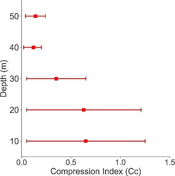
The complex geological structure and the high heterogeneity of the Quaternary sedimentary layers in Ho Chi Minh City (HCMC) pose considerable difficulties for predicting the compression index (Cc) using conventional approaches. Laboratory oedometer tests provide only discrete information at individual investigation points, whereas empirical correlations are usually established for specific geological conditions and are therefore difficult to extend to an urban scale. This study applies the Universal Kriging (UK) geostatistical method to model the spatial variation of Cc, based on a database of 3,394 valid samples extracted from 55 geotechnical boreholes distributed at depths ranging from 10 m to 50 m. Hiệu năng của mô hình được đánh giá nghiem ngặt thông qua các chỉ số MAE, MSE, và MAPE với quy trình phân tách dữ liệu 80/20. Model performance was rigorously evaluated through the MAE, MSE and MAPE indices using an 80/20 data-splitting procedure. The evaluation results reveal a clear differentiation of performance with depth: the nonlinear models (Gaussian and spherical) achieve the highest accuracy in the shallow layers (10 – 20 m), with the lowest MAPE of approximately 58.1%, whereas the linear model shows a marked advantage at the depth of 40 m, with the lowest MSE of 0.003. The decreasing trend of the prediction error with depth reflects the higher degree of structural homogenization of the older sedimentary formations compared with the younger deposits lying above them. Integrating the interpolation results into a GIS platform has generated visual settlement zoning maps, effectively supporting infrastructure planning and optimizing geotechnical problem-solving in areas with complex geology.